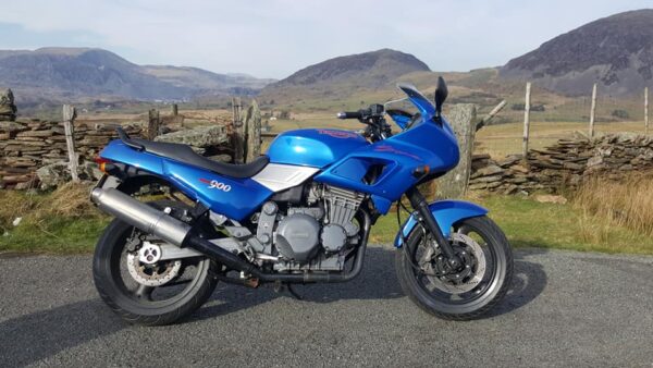
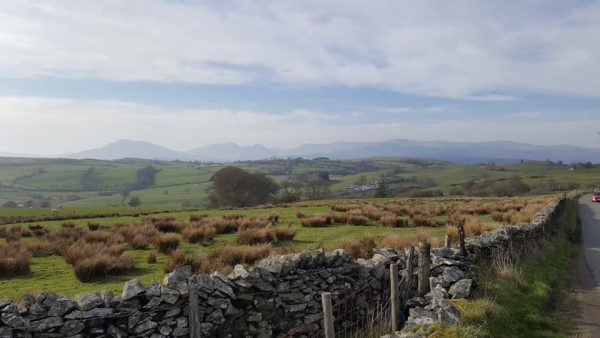
The recent spell of warm weather in Febuary has meant that Linda and I have been able to take a couple of longer rides on my old 1993 Triumph Trident Sprint and as the boys in blue were running a “casualty reduction initative” Op-Darwen. I thought that as well as some of the more widely used routes, I would use some of the beautiful but less travelled roads around here and had a great day out, hardly seeing any one else on the roads. So I thought I would share some of these routes with you guys.

As I have just mentioned I completed this route two up on a reasonably heavy tourer (1993 Triumph Trident Sprint), but I wouldn’t recommend trying it on some of the larger cruisers and tourers, as the road surface is in places quite poor and some of the ‘B’ roads require good low speed bike control.
So these routes will all be circular starting and finishing at my shop in Penmaenmawr, but of course you are free to dip in and out of the where ever they cross the more regularly travelled roads.
Happy Biking.
Section One
Penmaenmawr to Betws Y Coed ( a popular easy section of open ‘A’ road )
Leave the shop heading toward Conwy, join the east bound carriageway of the A55 at J16 and continue for approx 6 miles leaving the A55 at J19 to join the A470 heading toward Llanwrst and Betws Y Coed. Betws is a very popular meeting spot for bikers to have a brew and a chat, but this route avoids it as also attracts the local police. But, don’t worry we’ll be stopping for a brew and a great fry up if you fancy one later. For the most part this is a nice easy ride with plenty of open bends and long straights, however watch out for a few rather tighter bends and police speed traps.
Section Two
Betws Y Coed to Blaenau Ffestiniog ( a stunning ride in the mountains on wide open ‘A’ roads )

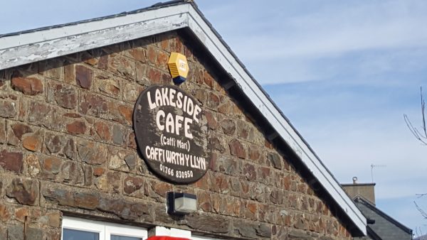
When you reach the Waterloo bridge ‘T’ junction instead of turning right toward Betws Y Coed turn left onto the A5 but, after only approximately 100m, rejoin the A470 by turning right and heading toward Blaenau Ffestiniog. The first part of this route is quite narrow and care should be taken until you have crossed the bridge just after the Fairy Falls. The road then opens up becoming a series of sweeping bends, on well surfaced roads, that flow well for the most part. But, watch out for the tight off camber uphill turn under the railway bridge about 1.5 miles after Betws. Continue towards Blaenau passing through Dolwyddelan at 30 mph, as you leave the village the road starts to climb and you will see the Dol (small castle) on the right. After a few sweeping bends, with one tighter slightly off camber uphill bend the run up the Crimea Pass is a stunning piece of open road with awesome views. It’s also popular with the police so keep it respectful. Shortly after you crest the pass you descend into Blaenau Ffestiniog, the terminus of the very popular Ffestiniog Railway, at the roundabout take the 3rd exit over the railway bridge onto the A496. Keep your eyes open and just after the Rehau factory take the right hand turn into Tanygrisiau, then take the first left, between the stone gate posts, and follow the road until you come to the Lakeside Cafe, set beside a scenic lake and waterfall, it is a great place for a brew or a fry up if you fancy it. Then, feeling suitably refreshed, re-trace the route to the roundabout in Blaenau, this time turning right through the town. Continue about four miles out of Blaenau to Llan Ffestiniog. Take the left turn at the ‘T’ junction, you will know it’s the right place as the junction is very tight and uphill (care required). As you leave the village turn a left onto the B4391 signposted toward Bala.

Section Three
Llan Ffestiniog to Cerrigydrudion ( Alpine like pass leading to a sweeping wide open section of moorland )
The climb out of Llan Ffestiniog starts almost straight away, it is a B road, so is a little narrower than previous sections, look out for the view point for great views back over toward the cafe. There is one twisty part where you feel like you are literally clinging on to the side of the mountain, but this shortly opens out onto a wide open stretch of moorland road that swings through the countryside for miles. The surface here is generally good but, watch out for blind bends and summits and ignore road signs at your peril. When you reach the A4212 turn left toward Bala, the road here well surfaced and twisty following the side of the Afon Tryweryn reservoir, I particularly enjoy the near 180 degree turn at the top of the lake, it just seems to go on forever, in one long controlled swoop. At Fron-Goch, just past the White Water Rafting Centre, turn left back onto another ‘B’ road the B4501. This route is a well surfaced road but, twisty in places and should be ridden with a certain amount of caution, keep your eye out for other road users, side roads and the occasional pile of gravel, washed down from driveways. After seven miles join the A5 turning left toward Cerrigydrudion.
Section Four
Cerrigydrudion to Pentrefoelas
This is a 9 mile long, wide open stretch of well known road, pleasant to ride but, often given the attention of the Arrive Alive van, you have been warned. When you reach Pentrefoelas (watch out for speed traps in the 40mph limit here) take the right turn in the middle of the village onto the B5113 toward Nebo. Previous comments about ‘B’ roads apply, but the views toward the mountains from this road are fantastic and well worth the ride. After 4.6 miles, shortly after passing through the hamlet of Nebo take a left on the B5427 back toward Llanwrst. This down hill section on narrow ‘B’ road is perhaps the most technical part of our journey and should be ridden at slower speeds, taking care to observe road conditions.

Section Five
Llanwrst to Penmaenmawr
This is simply a reversal of the start of the route back along the A470 toward Llandudno and turn left at J19 of the A55 back to Penmaenmawr. In total you will have travelled approximately 92 miles and covered a few of the less travelled roads in this stunning part of the world, I hope you have enjoyed the ride, I did!
Using google maps I’ve plotted to route for anyone who wants to follow it or you can find it here: